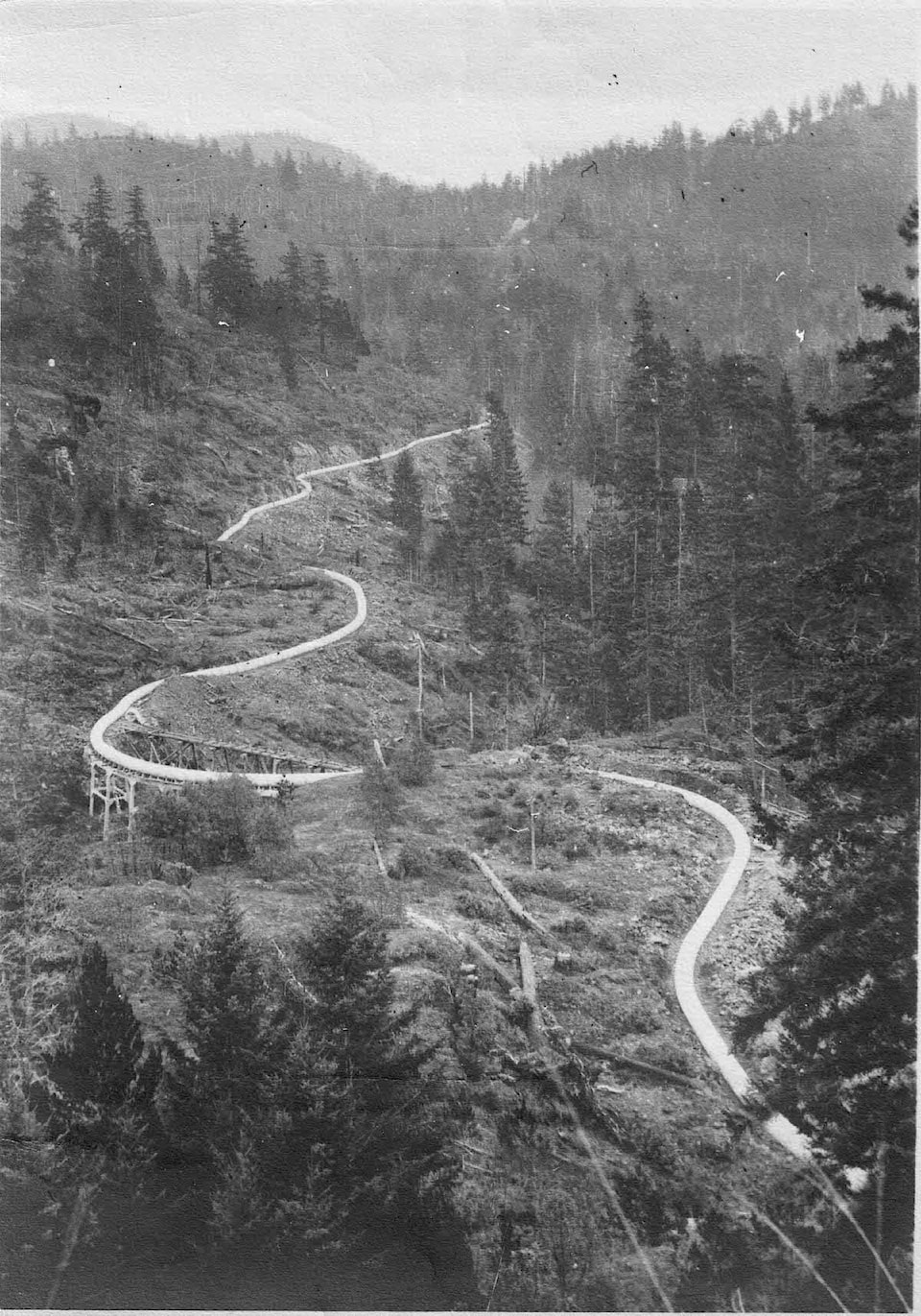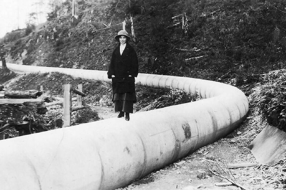
What was once a water main transport is now sometimes used as a 43.9-kilometre West Shore hiking trail, meandering through the woods from Mount Wells Regional Park, past Sooke Potholes until Sooke Lake.
And while the Sooke Flow Pipe Trail has gained attention from hikers who have discovered it, the Capital Regional District said it is hazardous and off-limits to the public.
“We ask the public to respect our signage and not use the flowline as it is not actively maintained and there are hazards associated with the use of the corridor,” said Andy Orr, senior manager of corporate communications at CRD.
Orr added there are currently no active discussions underway to transfer the flowline to regional parks or to upgrade the structure for safe public access.
However, hikers are still using the obscure trail, partly drawn by the mystery of abandoned places. It’s designated as a “challenging route” on alltrails.com that takes on average 10 hours and 55 minutes to complete. Though rated highly by many users for the views and geography, some hikers note its hazards.
“Would not recommend bringing pets or children as the pipe can be slippery and easily can be fallen off. If you are afraid of heights or have poor balance, do not go on this hike,” Trevor Richardson said on Google Reviews.
Another hiker, Matthew Bridges, said in an email it’s unlikely to see other people on the trail.
“I hiked it twice, once in the early spring and once in the summer, and both times I didn’t see a single other person on the pipe despite walking along it for 90 minutes or so. The pipe is mossy and quite narrow. Two big fellas would struggle to get past one another and you’d probably need to step off the pipe. And there are sections where you can’t really step off, and the drops on either side of the pipe can be quite sheer,” he said.
While public access is not permitted, the history of the flowline is still one that can be admired.
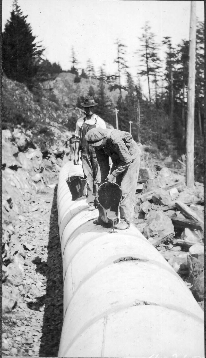
The 42-inch diameter concrete structure was originally built to meet the increasing water demands of an expanding Greater Victoria. Orr said the flowline originally provided water from Sooke Lake Reservoir to Humpback Reservoir and was in full use from 1915 to 1970. Once the Kapoor Tunnel was in service in 1970, a 29.5-km portion of the flowline from the Sooke River Road Treatment Facility (Charters Creek) to Humpback Reservoir was taken out of service.
The 14.5-km northerly portion was the only remaining of the flowline, staying in service from 1970 to 2009. In 2009, an underground pipe was installed under the Galloping Goose trail to provide water from the head tank at Sooke Reservoir to the Sooke River Road Treatment Facility. The upgrade made the original flowline redundant and in 2009, it was taken out of service.
Signage has since been installed on the trestles, stating that public access is not permitted.
READ MORE: Take a hike in Sooke BC
PHOTOS: Victoria Motorcycle Club hill climb returns to Metchosin